It looks as if Tropical Storm Henri is on its way to the East Coast of the United States. In this article, we’ll look at the storm’s path and intensity. We’ll also look at how the area will be affected, and what people should do if they find themselves in its path.
Tropical Storm Henri
Table of Contents
Tropical Storm Henri is expected to bring storm surges and heavy rain to southern New England, Long Island, and parts of New York. The storm is forecast to reach the Northeast coast on Sunday night or Monday. Some areas could experience life-threatening flooding.
Hurricane watches and flood warnings have been issued for parts of the Northeast. This includes the New York City area, the Hudson Valley, and the northern Connecticut and Rhode Island coastlines. A coastal flood advisory will be in effect from 6 pm to 11 pm Sunday night.
Tropical Storm Henri is expected to strengthen into a hurricane before landfall. It is expected to bring a storm surge to southern Massachusetts and eastern Long Island. While the storm hasn’t been as powerful as Superstorm Sandy, Henri’s swells could still cause life-threatening surf.
Henri’s intensity
Hurricane Henri has been moving toward the northeast. It is expected to make landfall along the Long Island and Connecticut coasts on Sunday. Depending on how strong the storm becomes, it could bring high winds and coastal flooding.
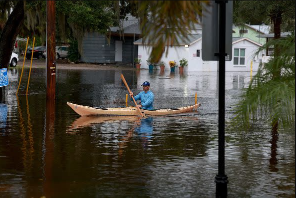
The storm is forecast to slow down as it approaches the coast. As it does, it will bring heavy rainfall and flash flooding to the area. In isolated pockets, rainfall totals could reach 6 to 10 inches. This will allow for the possibility of significant coastal flooding, including power outages.
Unlike Hurricane Sandy, which made a hard left turn and made landfall in New York City, Hurricane Henri will take a more plodding path. Instead of quickly approaching the coast, it will spend the night over warmer waters near Bermuda, dragging westward.
Henri’s predicted path
The predicted path of Hurricane Henri continues to move toward the New York and Connecticut coasts. Although it is weaker now than when it made landfall in Rhode Island, Henri will still bring heavy rainfall, and potentially a storm surge, to the Northeast.
By late Saturday evening, Henri is expected to make landfall on Long Island, New Jersey, or southern New England. It will then move east-northeast across northern Connecticut and southern Massachusetts on Monday.
The intensity of the storm will play a key role in steering. Henri is now forecast to make a hard left turn before coming ashore. While this could be less dramatic than Hurricane Sandy’s turning, it would cause major flooding. In addition, the incoming tide could add to the damage.
Long Island
As Hurricane Henri continues its track, residents of Long Island, New York should continue to prepare for heavy rains and high winds. The National Hurricane Center is forecasting a tropical storm that will make landfall on the East End of the island in early Sunday morning.
Governor Andrew Cuomo and other officials have declared a state of emergency. They are encouraging citizens to stock up and be ready for extended power outages.
According to AccuWeather meteorologist Brian Lada, the storm is still expected to bring heavy rains, which could result in flash flooding and urban flooding. Some areas are projected to receive up to 12 inches of rainfall.
Power outages are also predicted to be a major issue with Henri. Forecasters say that some areas may experience power outages that last for as long as seven to 10 days.
Connecticut
Tropical Storm Henri is expected to bring moderate to heavy rain to parts of the state. Heavy rain could cause flooding and erosion. The heaviest rain is expected to occur in the northeast, but some higher amounts are possible in coastal areas.
While Henri will weaken, it is still a major concern. Flooding and river flooding are likely. Power outages are likely, especially in the southeastern part of the state.
The storm’s track has changed, and it may stall near the Connecticut-New York border tonight. However, it is still expected to churn across northern Connecticut and southern Massachusetts over the next few days.
Flash flood warnings were issued for much of eastern Connecticut. More than 21,000 homes were reported without power in the state at 2:30 p.m., and Eversource reported more than 6,000 outages.


